RESEARCHERS from the National Oceanography Centre Southampton (NOCS) and the University of Southampton have developed a technique to predict the dispersal and drift patterns of large floating "islands" of pumice created by volcanic eruptions at sea.
These pumice fragments can spread to affect a considerable area of the ocean, damaging vessels and disrupting shipping routes for months or even years.
Post-doctoral research fellow at NOCS Martin Jutzeler and a team of colleagues simulated the drift of a massive 400-kilometre square raft of pumice from Havre, a deep submarine volcano in the southwest Pacific, using a high-resolution model of the global ocean circulation.
The team then tested the results against satellite imagery plus direct observations from sailing crews, to show that they can accurately reproduce surface drift using this method.
They believe the technique can be used to forecast dispersal routes of potentially hazardous pumice rafts from future eruptions and allow enough advance warning for protective measures to be put in place on shipping routes or in harbours.
"Pumice in rafts can drift for years, become waterlogged and sink, or become stranded on shorelines," said University of Southampton oceanographer Bob Marsh.

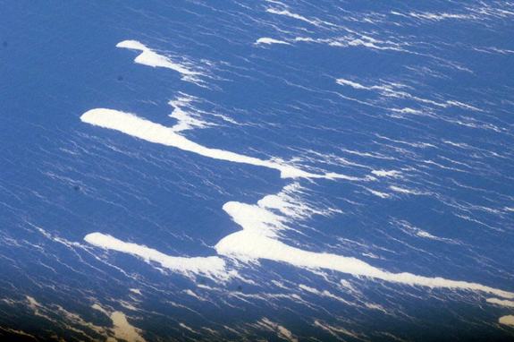
What is pumice raft? (wikipedia)
A pumice raft is a floating raft of pumice occasionally created by ocean-based or near-ocean volcanic activity.
Biologists suggest that animals and plants have migrated from island to island on pumice rafts.
Astrobiologists have hypothetically linked pumice rafts to the origin of life.